February is Black History Month in the US and Canada, and one historical fact that was brought to our attention by FABNYC and the Village Preservation Society is that the very first community of free Black people in North America was established in lower Manhattan beginning in 1643, more than 200 years before the Emancipation Proclamation outlawed slavery in all US states.
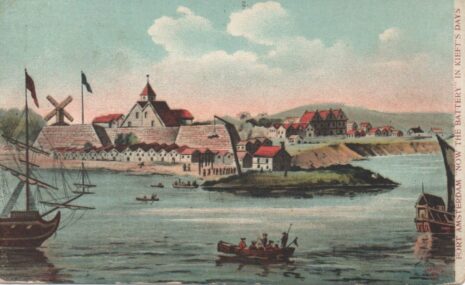
To see exactly where the settlement was, you can check out the Village Preservation Society’s Civil Rights & Justice Map here. Based on the research of historian Christopher Moore, the settlement was made up of individual landholdings bequeathed to former slaves of the Dutch West India Company, as a “reward” for years of loyal servitude. Of course, this was not a purely altruistic act; the settlements conveniently served as a buffer zone between the colonial invaders and the indigenous groups they displaced. Sound familiar?
Even though the English subsequently outlawed the settlements when they took over from the Dutch in 1664, demoting the settlers from free persons to “legal aliens” who were not permitted to be landowners, some biographical information about the free Black settlers is still available, as well as the exact boundaries, sizes and locations of their individual properties.
Here are some details about the African landowners and their properties:
Manuel de Gerrit de Rues: Manuel de Gerrit de Rues was granted twelve acres of land in December of 1643. Prior to his manumission, he was one of eight slaves involved in the death of another slave and was charged with murder in 1641. Rather than choosing to execute all eight men, Dutch officials ordered them to draw straws. Drawing the shortest straw, Manuel de Gerrit de Rues was sentenced to death by hanging but survived the fall from the execution ladder. Witnesses begged officials not to attempt a second execution. Manuel de Gerrit de Rues was released and was granted farmland as a free man only two years later. His settlement was located west of the Bowery, stretching upwards from its southern boundary near Bond St toward East 8th St and Astor Place.
Manuel Groot (Big Manuel): Manuel Groot, or Big Manuel, was among the first Angolan slaves ever owned by the Dutch West India Company. On the 21st of December in 1644, he was granted eight acres of land by the Council of New Amsterdam. His settlement stood adjacent to those of fellow manumitted slaves Manuel Trumpeter and Anthony Portuguese, with the northernmost corner of the parcel located near West 4th and Washington Square East, stretching down towards West 3rd and LaGuardia Pl, and moving southwest towards Bleecker St and Broadway.
Cleyn (Little) Manuel: Cleyn (Little) Manuel was granted a ten acre parcel of land by the Council of New Amsterdam following his manumission in December of 1643. His settlement neighbored the properties of Manuel Groot, Cleyn (Little) Anthony, and Anthony Portuguese. The northernmost point of Manuel’s settlement touched West 3rd St while its southernmost point reached W Houston St, spanning across Thompson St east towards Mercer St. and encompassing a large portion of what is now modern-day Mercer Playground.
Gracia d’Angola: After being granted ten acres of farmland on December 15, 1644, Gracia d’Angola settled on a parcel of land which ran parallel to the closely neighboring property of fellow manumitted slave Cleyn (Little) Anthony. The northernmost point of Gracia’s farm was located near what is now the intersection of W Houston St and Wooster St, stretching downwards toward Spring St and eastwards toward Mercer St.
You can learn more about this by visiting the Civil Rights & Justice Map here, as well as find other Black history sites all over lower Manhattan.